Kangaroo Island Bushfire Management Committee
c/o Mr Dean Brooksby, Council Fire Officer
Dauncey Street, Kingscote, SA 5223
American River, 2011.01.26
Dear members of the Kangaroo Island Bushfire Management Committee, following a number of discussions between Mrs Irene Halley, who was the American River representative on the KI BMC while the KI Bush Fire Risk Management Plan was set up, Mr Graham Walkom, KI Councillor and American River resident, Mr Dean Brooksby, Council Fire Prevention Officer, and myself, there is an item of the utmost importance for the safety of the town of American River that needs to be clarified.
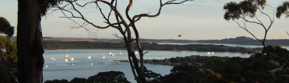
American River is classed as Very High bushfire risk. It has always been common knowledge that the main reason for this dangererous state of affair is the lack of a bushfire break close to the north of the town, where there is significant fuel load immediately adjacent it. To a lesser extent, there is also a bushfire risk from the west.
Accordingly, and logically, the BMC discussed in its original plan two strategic provisions:
– a firebreak and track to be created on the western and northern boundaries of the northern part of the town, all the way from Red Banks Road to Wattle Avenue;
– the existing track running from Wattle Av. to Ballast Head Rd to be widened and preferably brought up to CFS GAFLC standard.
The western leg of the firebreak and track was quickly implemented in September 2009, but hydro-axe works on the northern leg, along the boundary of land-owner Neil Stoeckel, were interrupted when it was found that at one point the terrain was too steep for the original plan to be implemented as is.
Senior members of the AR CFS did an on-ground inspection and approached Mrs Halley with an alternative solution that entailed a firebreak and track to be located on two adjoining ridge-tops a little further north, oriented to the south-east down to Wattle Avenue, thus permitting implementation of the original plan that called for an uninterrupted firebreak and track to run all the way from Red Banks Road to Wattle Avenue. This modification had the approval of the land-owner concerned, Mr Neil Stoeckel.
For reference on this matter, I include copy of Mrs Halley’s letter published in The Islander of 2010.12.23.
On 2009.09.24, at the last meeting of the BMC where the final provisions for KIBFRMP were discussed, the difficulty for implementing the northern leg of the planned firebreak was discussed and it was decided that a solution to this problem would be found. On the 28th, in an Appendix B attached to the meeting minutes, amendments were presented to the KIBFRMP.
The ones of interest to us are the last two to be found in the section Treatments (BFRR):
– “Removal of Am Rvr break through Stoeckel boundary”
– “Addition of fire access track works on continuation of Wattle Ave, American River”.
This is where the whole issue becomes unclear. Mrs Halley does not adhere to the notion that these amendments implied that the northern leg of the originally planned firebreak and track was once and for all forfeited.

original plan of Sept. 2009 showing a fire-break (orange line) to the north of the town of American River
Of course I cannot determine of the exact intentions of the BMC in September 2009, but considering that the original map for AR, including a complete firebreak (), could still be found until at least March 2010 attached to the KIBFRMP on the official website; that the wording of these two aforementioned amendments is somewhat ambiguous; and, most importantly, that it is hard to conceive that the main reason for a tourist town classed as Very High bushfire risk could, out of the blue, be decided not to be addressed — it is understandable that the American River community would strongly dispute any non-implementation of a firebreak and track immediately to the north of the town.
Up to recently, our contacts with Council were detestable, but thanks to the understanding, competence and common sense of Mr Brooksby, this has changed. At this point, I would like to make a suggestion for a constructive outcome: forget about the past and its diverse possible interpretations, and avoid getting bogged down in a bureaucratic battle of egos.
The implementation of the northern leg of the firebreak and track is relatively easy to implement and only a matter of Council spending a few thousands dollars, with many local residents happy to help on site during the works. So financial resources are not the main sticking point for this particular item. What is important is that it gets through all the necessary official process for approval and implementation.
So if you determine that yes, the wording of the 2009.09.28 amendments does not preclude the completion of the firebreak and track in the variant as suggested by the AR CFS, please confirm this with Mr Brooksby.
If you believe that no, you disagree, the amendments wordings do not allow for the northern leg of the firebreak and track and Mrs Halley was wrong in her understanding of your last KIBFRMP meeting discussions, please consider urgently amending the KIBFRMP.
In doing so, please consider another perspective is that the original plan included western leg (completed) for a firebreak and track, a northern leg (mostly undone) and the Wattle Avenue track to Ballast Head Road (completed, but not to GAFLC standard). This indicated that these three components were required. Yet, the final plan would only include the Wattle Avenue track and the western leg of the firebreak and track. The community cannot see how this drop in commitment would yet amount to the same level of protection.
Advice from Councillor Walkom is that Council is quite concerned about bushfire obligations and costs and that it has a preference for significantly involving communities in decisions and self-help projects. As stated, the implementation of this firebreak is not a particularly expensive action to be taken, and has very strong support in the AR community, which feels threatened in the present situation. Indications are the cost to bring Wattle avenue track up to standard may be up to $ 20’000. And this would leave a large area of vegetation visibly decimated. The ridge-top alternative for the northern leg of the firebreak and track is a fraction of this cost and the community would contribute significantly to the project, with cash, kind and ongoing maintenance. It is basically understorey cleanup and requires the removal of no significant trees.
Looking forward to a positive outcome,
Respectfully,
Dr Gabriel Bittar
American River resident
Falie Court area fire-prevention group spokesperson
***********
On behalf of the Kangaroo Island Management Committee, Chris Martin, Regional Commander, CFS Region 1, responded on 11.02.2011:
“(…) A number of the members of the Committee have visited the area on several occasions. After careful consideration of the request, including: review of overall fuel hazard in the area, recorded fire history, likely fire behaviour and tactical response strategies, the Committee determined that it will not amend the Kangaroo Island Bushfire Risk Management Plan to incorporate the requested variation. (…)”