by Dr Edward Duyker
‘Circumnavigating Napoleon Symposium’
National Gallery of Victoria,
Melbourne, 21 July 2012
Edward Duyker is Honorary Professor of the Australian Catholic University and an Honorary Senior Lecturer of the University of Sydney.

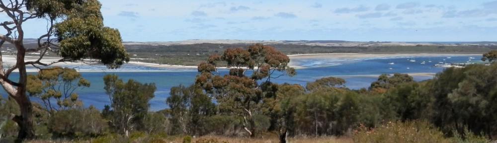
Terre-Napoléon_Kanguroo-Island_1802-1803
Nicolas Baudin’s expedition with Le Géographe (red, blue and yellow), Le Naturaliste (red), Le Casuarina (yellow)
I am going to speak today about one object on display in the NGV’s ‘Napoleon’ exhibition which has drawn particular attention from the public and the media.[1] It is the map of southern continental Australia bearing the name ‘Terre Napoléon’. You will find it reproduced on page 147 of the exhibition catalogue. It was drafted by Louis de Freycinet for plate 10 of the first part of the atlas of the Voyage de découvertes aux Terres australes published in 1811. This was just one of the published results of the expedition of Nicolas Baudin to Australian waters approved by First Consul Bonaparte in March 1800. In the wake of Baudin’s death in Mauritius, in September 1803, the official historical account of his expedition was written by François Péron. He was initially one of Baudin’s most junior scientific staff members. He had originally sought appointment as a self-styled ‘anthropologist’ to the expedition; instead he gained a place last on the list of zoologists as an élève or trainee ‘specially charged with comparative anatomy’. But as his colleagues either deserted or died, Péron would rise to prominence within the expedition’s ranks. Unfortunately for Baudin, Péron utterly loathed his commander.
Péron arrived back in France in March 1804, in the last months of the Consulate: a repressive police state with no free press and few remaining republican virtues—a state at war and subordinate to the demands of the military. It was the same month in which the hapless young Duc d’Enghien was kidnapped and summarily executed in the fosse of the Château de Vincennes on the orders of the First Consul for Life, Bonaparte. (But what was one murder for a man who could order the cold-blooded execution of 3000 prisoners of war on the beach at Jaffa in 1799?) Péron sought to win the favour of this ruthless administration. He managed to gain the attention of Madame Bonaparte and the ‘director’ of her gardens at Malmaison, François Brisseau de Mirbel,[2] after whom the Australian plant genus Mirbelia is named. For all her frivolity and impecunious extravagance, Joséphine was genuinely appreciative of the natural splendours brought back to France by hardworking zoologists, botanists and gardeners. Indeed, Malmaison would become a focus for several important natural history publications and splendid artistic endeavours.
Joséphine’s apparently warm letters to Péron have not survived, but a copy of one of his replies to her, on 12 May 1804, is preserved among the Lesueur Collection in Le Havre. It is clear that Péron gave her insect specimens, plant seeds, and even the expedition’s ethnographic collection. The latter included a rich collection from Oceania made by Surgeon George Bass, the discoverer of Bass Strait.[3] We also know that he pleaded for Joséphine’s intercession, so that he could publish the results of his work carried out under the ‘auspices of her glorious spouse’.[4]
About the same time, or soon after, Péron drafted a letter to Bonaparte himself and requested permission to publish the ‘Zoography of New Holland’ at government expense. He would never publish such a work and his drafts of further pleading letters became ever more sycophantic after the First Consul for Life abjured his republican commitments, declared himself Emperor and reinvented his wife as an Empress and his Corsican family and gang of generals as a new aristocracy. But gaining the attention of the Emperor was problematic even for the Empress; he was often absent from Paris and busy bathing Europe in blood. In some cases with the help of some of my ancestors.
Nevertheless, Péron’s star continued to rise in Paris, particularly with his election as a corresponding member of the Institut impérial, France’s peak scientific body, in October 1805. By June 1806, the government had already resolved to publish Péron’s Voyage de découvertes aux Terres australes. Nevertheless, the official Imperial decree actually dates from 4 August 1806. In it, the government only undertook to publish the first three volumes—historical, anthropological, physical and meteorological—at government expense, with natural history to be published by subscription.[5] In 1987, my late friend Frank Horner, in his wonderful book The French Reconnaissance, argued that the imperial toponyms for the Voyage were adopted by Péron and Freycinet while the former was still employed by the navy minister in the ‘hope of reviving the flagging interest of the Emperor’, rather than through coercion–as the explorer Matthew Flinders and the geographer Conrad Malte-Brun believed.[6] Yet what is clear from Péron’s correspondence with Jean-Marie Degérando, is that his draft chapters were subject to personal scrutiny and arbitrary change by the minister.
While there is little doubt of Péron’s calculated sycophancy, this should still be considered in the context of the suffocating hubris and narcissism of the Napoleonic despotism and the culture of subservience, exaggerated court etiquette and flattery which the self-styled heir to the Roman Emperors and Charlemagne now insisted upon. The insertion of ‘Terre Napoléon’ on the chart of southern Australia was only one arrogant example which characterized the period. In Brittany the town of Pontivy became ‘Napoléonville’; in the ravaged Vendée, La Roche-sur-Yon was reconstructed as ‘Napoléon-sur-Yon’ and the neighbouring towns of Le Poiré, Le Bourg and Beaulieu, all had ‘sous-Napoléon’ appended to their names. Major fortifications in Ostende (in Belgium) and Almaraz (in Spain) were also ‘baptized’ in the Emperor’s name. Even in the distant outpost of the Ile de France (my mother’s native Mauritius), Captain-General Decaen changed the name of Port Nord-Ouest (formerly Port-Louis) to Port-Napoléon and Mahébourg to Port-Impérial in 1804.[7] And in August 1806, the island of Réunion (formerly Bourbon) was renamed ‘Ile Bonaparte’.[8] Matthew Flinders, a prisoner of war at the Ile de France at the time, would have been well aware of these surrounding toponymic changes and of the political culture which demanded the propitiation of the demigod Bonaparte.[9] It should also be remembered that if the Voyage had been privately published, it would still have required the imprimatur of the imperial censor.
It seems very unlikely that Péron, Freycinet and Lesueur could have issued such a politically sensitive atlas and accompanying narrative with names which were entirely of their own choice or which recognized the names of the Englishman Flinders — even if such names were known to them — or the prior geographical and territorial claims of France’s enemy. Conrad Malte-Brun, who knew Péron personally, certainly believed that he was troubled by the lack of acknowledgement that Flinders received in the Voyage de découvertes aux Terres australes and declared: ‘M. Péron, the French scientist, conversing on the subject of the discoveries of the English navigator, always appeared to us agitated by a secret sorrow, and gave us to understand that he regretted not having the freedom to say all he knew about them’.[10]
During the Bourbon Restoration and six years after Péron’s death, Louis de Freycinet would conveniently absolve himself of responsibility for the imperial toponymy of the official account when he wrote the preface to volume II of the Voyage. Although he shifted the blame onto his late friend, he did so with subtle acknowledgement of the norms and difficulties of the period. ‘Péron had conceived the project of all the names of all the places we had visited’, wrote Freycinet, and he added, ‘this project had been adopted by the authorities; it thus had to bear the imprint of the epoch during which our expedition had been undertaken and the circumstances in which Péron had written the account’.[11] For his part, Péron only referred to what ‘our geographers have named’[12] when he mentioned Cape Péron on Maria Island, christened in his honour.
In times of despotism or foreign occupation, there are those who actively collaborate and make Faustian contracts out of conviction or self-interest and still more who passively collaborate because they have little choice. Napoleonic France was in many respects the precursor of the totalitarian dictatorships of the twentieth century. As in those dictatorships, Bonaparte crushed all free expression of opinion with ruthless censorship and sought to control the very minds of his subjects; he also co-opted a generation for the prosecution of aggressive war, conquest and the fulfillment of a megalomaniacal sense of destiny.[13] Péron was only one of many obedient subjects — but also careerists and hero-worshippers — who helped to legitimize Bonaparte’s rule; in his (and Freycinet’s) case with the Emperor’s name written large across the expedition’s Atlas. But we must not forget that science was then very much subordinate to the Emperor’s will. The Ecole Polytechnique, for example, had already been militarized and, in the year the first volume of Péron’s Voyage appeared (1807), Bonaparte made it abundantly clear that he believed that the Institut impérial existed to fulfil his wishes and that its members had no right to object to tasks he assigned.[14] In such an environment, is it really possible that Baudin would have been any less compliant than Péron, had he lived to write the official account of the expedition? It seems unlikely. He too was an obedient servant of the then First Consul and diligently fulfilled his orders—even to the extent of ripping out cabins to satisfy Mme Bonaparte’s whim for living Australian animals. His recompense may have been the honour of a Baudin Peninsula or a Cape Baudin, where today the map bears the names of Péron and Freycinet. And perhaps some of his sarcastic manuscript names, such as Cap des Mécontents and Anse des Maladroits, might have survived, instead of Cape Naturaliste and Vasse River (Wonnerup Inlet) on Geographe Bay in Western Australia, to commemorate the unfavourable opinion he held of some of his men.
As I have just mentioned, the first volume of Péron’s Voyage was published by the Imprimerie impériale in 1807. Péron is reported to have personally presented a copy to the Emperor after Mass on the morning of Sunday 10 January.[15] Two German editions and an abridged English translation soon followed. It was peppered with French toponyms, in many places where one might have expected an acknowledgement of the priority of Matthew Flinders.
Although he died in 1810, four years before Flinders’s charts were published, Péron must have had some knowledge of Flinders’s toponyms — such as Kangaroo Island — after the Géographe’s meeting with the Investigator at Encounter Bay. Furthermore, he was apparently present when Flinders showed Baudin a draft chart at Port Jackson. Flinders, however, refused to think ill of Péron whom he came to know personally; he was more inclined to blame the Napoleonic régime: ‘I believe’ declared Flinders, ‘his candour to have been equal to his acknowledged abilities and that what he wrote was from over-ruling authority, and smote him to the heart.[16]
Imperial pressure, or sycophancy, or both may explain Péron’s failure to acknowledge Flinders’s priority, but it is possible that Péron, as a zoologist, simply adhered to the conventions of the natural sciences. Regardless of whether a scientist is the first to discover, collect or describe in manuscript form a plant or animal species, if he or she is delayed in publishing, someone else has an opportunity. Even today, belatedly published manuscript names are still regarded as mere synonyms.
It remains to be said that the British hardly had the right to cast the first stone. Governor King, clearly anxious that the French might establish a colony on the D’Entrecasteaux Channel, in Van Diemen’s Land, persisted in referring to the waterway as the ‘Storm Bay Passage’, even in a letter to Baudin.[17] And in a letter to Lord Hobart, of 24 June 1803, he acknowledged that it was called by ‘the French “Le Canal D’Entrecasteaux” to whom they attribute the discovery of that passage’.[18]
And while Flinders named Cape Willoughby on Kangaroo Island, he did not name the peninsula from which it juts. On Freycinet’s chart of New Holland the previously unnamed peninsula bore the name ‘Presque’île La Galisonnière’. For all the criticisms heaped on Péron for appending French names to Flinders’s prior discoveries, it is worth noting that since August 1874 this same peninsula, which was first surveyed in its entirety and first named by the French, has honoured the Christian name of a Californian lawyer, Dudley Field, father-in-law of South Australia’s Governor Anthony Musgrave (1828—1888).[19] It would seem that for Anglo-Saxon sensibilities, ‘Dudley’ was preferable to the name of one of France’s greatest naval heroes, responsible, as Péron gleefully pointed out, for the defeat of the unfortunate Admiral Byng at Minorca!
The question still needs to be asked: was there ever a prospect of a ‘Terre Napoléon’ actually settled by France? It should be remembered that the French had reached Van Diemen’s Land before the British. Marc-Joseph Marion Dufresne’s expedition, the first after Abel Tasman’s, anchored on the east coast for five days from 6 March 1772 in waters embraced by Marion Bay now named in his honour. Thirty years after Marion Dufresne’s visit, France seemed even more likely to colonise Van Diemen’s Land, in British eyes at least, given the statements of François Péron. Although the Baudin expedition had no such orders, in 1802 Péron brazenly told Colonel Paterson (who then told Governor King!) that France ‘had the plan to make a settlement on d’Entrecasteaux’s Channel’.[20] The British knew well that the Channel was first charted by the French in 1792 and revisited by them in 1793 and 1802. It should also be remembered that in 1800 the naturalist Labillardière had stated that the D’Entrecasteaux Channel ‘might present great advantages to a commercial nation’.[21] Governor King would take no chances; that commercial nation would be Britain rather than France. Thus Baudin’s second-in-command, Hamelin declared indignantly that the ‘English are about to take from us the D’Entrecasteaux Channel, where it would . . . interest the French Republic very much to have a settlement’.[22] Twenty-three years later there was a similar scenario: news of Dumont d’Urville’s voyage provoked preemptive British settlement of Western Port and King George Sound by Governor Darling (on the orders of Lord Bathurst) in late 1826. I should add that Western Australia had been visited and claimed (in one of the flag-raising pantomime’s of the time) as early as March 1772 by another French explorer: François Marie Aleno de Saint-Aloüarn.
There was, of course, an alternative to founding a French colony in Australia and that was to capture a pre-existing British one. This is precisely what François Péron advocated on returning to Mauritius and learning of the collapse of the Peace of Amiens in 1803. Péron thought that this could be done with the aid of rebellious Irish convicts. In 1810, the year Péron died, Bonaparte did finally order Vice-Admiral Decrès, the Navy Minister, to “faire prendre la colonie anglaise de Jackson” [take the English colony of Jackson].[23] Of course it was pure political whimsy; France did not have the naval resources to do this. Indeed at the end of that very year, Mauritius, Bonaparte principal naval base in the Indian Ocean, would fall to the British.
I am not sure whether our indigenous inhabitants would have fared better under France than Britain. There is no doubt that a number of French explorers, Labillardière, d’Entrecasteaux, Péron and Baudin, pursued inter-cultural exploration here joyfully, peacefully and admirably. But had France settled Van Diemen’s Land prior to the Revolution, we might now have been dealing with a legacy of slavery. Bonaparte for all the fine phrases of progress and individual liberty with which he dressed-up his despotism, did not extend freedom to the slaves of his colonial empire. (I should propose a toast at this point to the much-maligned Governor Hudson Lowe who liberated the slaves of Saint Helena!)
The late-eighteenth century has other lessons for us regarding what Van Diemen’s Land (if not Victoria) might have been like under French rule. When France sided with the American revolutionaries during the American War of Independence, a number of formidable expeditions were mounted from French colonies. In Mauritius, many colonists took up privateering (state-sanctioned commerce raiding). But while Mauritius did not have a hinterland large enough to provide adequate naval stores, Van Diemen’s Land and Victoria (or should I say ‘Terre Napoléon’) could have fulfilled that purpose well. Its worth looking at the Mauritian statistics. Between 1793 and 1802, the local French naval squadron and 18 armed local merchantmen-turned-privateers preyed on British Indian shipping with spectacular success: more than 176 British ships were taken as prizes! Shipbuilding and commerce-raiding became major local industries.
However, even if colonial Van Diemen’s Land and perhaps Western Port Bay in Victoria had started out French, I think it highly unlikely that they would have remained French in the wake of the destruction of French seapower at Trafalgar. British arms would soon have taken Tasmania – as Quebec was conquered in 1759 and Mauritius was conquered in December 1810. But, who knows, perhaps Bonaparte would have seen the writing on the wall and thrown his Franco-Australian colonies in as sweetener when he sold off Louisiana to the Yanks in 1803 for $15 million. Given the natural frontier of Bass Strait, perhaps a Tasmanian version of the Louisiana Purchase would have left Tasmania looking like an even more far-flung Hawaii or Alaska on the nose of Anglo-Canada, or, in our case, Anglo-Australia. Ultimately, the imperial omnivore Britain, gobbled up the entire Australian continent and its offshore islands. Despite the injustices done to the indigenous people, a head of state who lives 17,000 kilometres away and a schizophrenic national flag, we can celebrate the political unity of one democratic continent between the Pacific and Indian Oceans, where women got the vote fifty years before France and where the legal system is based on the principle of habeas corpus, something entirely absent from the Code Napoléon.
Thank you!
[1] See, for example, Maunder, P., ‘How Very French’, The Age, 20 May 2012, pp. M8–9.
[2] Mirbel is mentioned in a number of Péron’s letters, including one to the Freycinet brothers, in which he describes him as ‘my friend’; see copy of a letter from Péron to one of the Freycinet brothers, circa 1804, without postal address, original in the possession of the Baron de Freycinet, Aubanais, Charente; Muséum d’histoire naturelle du Havre (MHNH), Collection Lesueur, Ms 22072.
[3] Péron, F., ‘Inventaire général de tous les objets relatifs à l’histoire de l’homme recueillis pendant le cours de l’expédition ou remis à M. Péron, naturaliste zoologiste du Gouvernement dans cette expédition, et présentés par M. Geoffroy et lui à Sa Majesté l’Impératrice Joséphine le 9 prairial an XII’, in Copans, J. and Jamin, J. (eds.) Aux origines de l’anthropologie Française: Les Mémoires de la Société des Observateurs de l’Homme en l’an VIII, Le Sycomore, Paris, 1978, pp. 195—203; see also Hamy, ‘Les collections anthropologiques et ethnologiques du voyage de découvertes aux Terres Australes (1801—1804)’, Comité des Travaux historiques et scientifiques, Bulletin de Géographie historique et descriptive, Année 1906, pp. 24–34.
[4] [Draft] Letter from Péron to Mme Bonaparte, 25? floréal an 12, MHNH, Coll. Lesueur, Ms 22054.
[5] Extrait du décret Impérial, rendu au Palais de Saint Cloud le 4 Août 1806, MHNH, Coll. Lesueur, Ms 22069-1.
[6] Horner, F., The French Reconnaissance: Baudin in Australia 1801—1803, Melbourne University Press, Melbourne, 1987, p. 333.
[7] Toussaint, A., Port Louis: A Tropical City (translated by W.E.F. Ward), George Allen & Unwin, London, second edition, 1976, pp. 59—60.
[8] Toussaint, A., Histoire des îles Mascareignes, Berger-Levrault, Paris, 1972, p. 136.
[9] Even an anonymous British reviewer of volume 1 of the Voyage (thought to have been John Barrow, Secretary to the Admiralty), believed Péron was not independently responsible for the political claims of his book: ‘. . . he must have been betrayed by superior influence. Of M. Péron, as a man of general science, we are disposed to think highly; but we repeat, that in the publication of the work before us, we do not and cannot consider him as a free agent. It is brought forward, in the first place, under the immediate sanction of Buonaparte, in consequence of a report of the Imperial Institute’; see, Quarterly Review, vol. iv, August 1810, p. 44.
[10] Malte-Brun, C., ‘Mémoire sur la découverte de la côte sud-ouest de la Nouvelle-Hollande, ou de la Terre Flinders, de la Terre Napoléon, et de la Terre Grant’, Les Annales des Voyages, de la Géographie et de l’Histoire; ou collection des voyages nouveaux les plus estimés, traduits de toutes les Langues Européennes: des relations originales, inédites, communiquées par des voyageurs Français et Étrangers, Chez F. Buisson, Paris, tome xxiv, 1814, p. 289.
[11] Freycinet’s preface, in Péron [and Freycinet], Voyage de découvertes aux Terres australes, exécuté par ordre de sa Majesté, l’Empereur et Roi, sur les corvettes le Géographe, le Naturaliste et la Goëlette le Casuarina, pendant les années 1800, 1801, 1802, 1803 et 1804, L’Imprimerie Impériale, vol. ii, Historique, p. viii.
[12] Péron, op. cit., tome i, p. 263 (Phillips trans., p. 205).
[13] I must admit to the profound influence of Pieter Geyl on this point. In the preface to the first Dutch edition of his masterly Napoleon: For and Against, drafted seven months before the Netherlands was liberated from Nazi tyranny, Geyl wrote: ‘He [Napoleon] was a dictator who attempted to break with new legislation what resistance was left in the old society; who intensified his power in the State by means of a centralized administration; who suppressed not only all organized influence or control and expression of opinion, but free thought itself; who hated the intellect, and who entered upon a struggle with the Church which he had first attempted to enslave; and who thought that with censorship, police and propaganda he would be able to fashion the mind to his wish. He was a conqueror with whom it was impossible to live; who could not help turning an ally into a vassal, or at least interpreting the relationship to his own exclusive advantage; who decorated his lust of conquest with the fine-sounding phrases of progress and civilization; and who at last, in the name of the whole of Europe, which was to look to him for order and peace, presumed to brand England as the universal disturber and enemy’. For a more recent study, see Desmond Seward’s Napoleon and Hitler: A Comparative Biography, Viking, New York, 1989.
[14] Hahn, R., The Anatomy of a Scientific Institution: The Paris Academy of Sciences, 1666-1803, University of California Press, Berkeley, 1971, p. 311.
[15] Anon., ‘Intérieur’, Le Moniteur universel, no. 13, mercredi, 13 Janvier 1808, p. 1.
[16] Flinders, M., A Voyage to Terra Australis: Undertaken for the Purpose of Completing the Discovery of that Vast Country, and Prosecuted in the Years 1801, 1802, and in 1803, in his Majesty’s Ship the Investigator, and Subsequently in the Armed vessel Porpoise and Cumberland schooner. With an Account of the Shipwreck of the Porpoise, Arrival of the Cumberland at Mauritius, and Imprisonment of the Commander during Six Years and a Half in that Island, G. and W. Nicol, London, 1814, vol. i, p. 193.
[17] Governor King to Baudin, 23 November 1802, in Bladen, F. M. (ed.) ,Historical Records of New South Wales, vol. 4. Hunter and King, 1800, 1801, 1802, Government Printer, Sydney, 1896 (facsimile edition, Lansdown Slattery, Mona Vale, 1979), p. 1007.
[18] Watson, F. (ed.), Historical records of Australia, series 1, Governors’ Despatches to and from England, vol. 3. 1801—1802, Library Committee of the Commonwealth Parliament, Sydney, 1915, p. 698.
[19] The name ‘Dudley’ was first given to the eastern-most ‘Hundred’ (administrative division) of the island and thereby to the peninsula; see Nunn, J. M., This Southern Land: A Social history of Kangaroo Island 1800-1890, Investigator Press, Hawthorndene (S. Aust.), 1989, p. 133.
[20] Ronsard, Journal, Archives nationales, Marine 5JJ 30, folio 42.
[21] Labillardière, J. J. H. de, Relation du voyage à la recherche de La Pérouse fait par ordre de l’assemblée constituante, pendant les années 1791, 1792, et pendant la 1ère. et la 2e. année de la République Françoise, 2 vols. and atlas, H. J. Jansen, Paris, An VIII [1800], tome i, p. 192 (Stockdale trans., pp. 136–7).
[22] Quoted by Frank Horner in The French Reconnaissance, p. 264.
[23] Correspondance de Napoléon Ier, tome xx, 1866, [document 16,544], page 467.